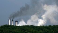
An instrument has launched from the United States to measure the world’s carbon and methane levels in an effort to help fight climate change.
The instrument is attached to a satellite called Tanager-1. It was launched August 16 by a public-private partnership called the Carbon Mapper Coalition. The satellite was carried to space aboard a SpaceX Falcon 9 rocket from the Vandenberg Space Force Base in California. Ground controllers reported they successfully established communications with the satellite shortly after launch.
A statement from NASA said the satellite is equipped with a gas-seeking instrument powered with “imaging spectrometer technology.” A spectrometer is an instrument used to study the chemical composition and structures of substances.
NASA’s Jet Propulsion Laboratory (JPL) developed the imaging spectrometer instrument. The joint project also involved other organizations, including Planet Labs PBC. The private company helped build the Tanager-1 satellite.
Tanager-1 is one of two satellites developed by the Carbon Mapper Coalition. The other satellite has not yet been launched.
The coalition says it aims to support the collection of detailed data on methane and carbon dioxide emissions worldwide. The coalition hopes to use the data to drive reductions in methane and carbon pollution. Scientists have linked carbon and methane emissions to warming temperatures on Earth. Many climate experts blame most of the warming on pollution caused by human activities.
NASA says the instrument aboard Tanager-1 measures “hundreds of wavelengths of light that are reflected by Earth’s surface.” This method permits the instrument to find sources of carbon and methane based on the light wavelengths they show.
The process produces “fingerprints” that the imaging spectrometer can identify, NASA said. This data can be used to provide highly detailed information on where the world’s carbon and methane come from. The level of detail is so exact, it can even identify “individual facilities and equipment,” the space agency added.
Laurie Leshin is director of the JPL, which is based in Pasadena, California. She said in a statement the imaging spectrometer technology is the product of more than 40 years of development at NASA. Leshin said such detailed emissions data can help policymakers, governments and environmental organizations worldwide.
When fully operational, Tanager-1 will aim to capture data across 130,000 square kilometers of Earth’s surface each day. This will permit scientists to identify specific gas clouds releasing carbon dioxide and methane. NASA said the collected data will be publicly available online at the Carbon Mapper data portal.
NASA says about half of methane emissions worldwide are caused by human activities. The biggest polluters are called “super emitters,” said Carbon Mapper Coalition chief executive Riley Duren. He told the Reuters news agency that super emitters produce more than 100 kilograms of methane per hour. This level of release could add up to 20 to 60 percent of an area’s total emissions in some industries, Duren said.
In addition, the agency noted, “There is now 50 percent more carbon dioxide in the atmosphere than there was in 1750, an increase largely due to the extraction and burning of coal, oil, and (natural) gas.”
Duren said in a statement the Carbon Mapper Coalition is a good example “of how organizations from different sectors are uniting around a common goal of addressing climate change.” He added that having the ability to exactly identify the sources of carbon and methane “can drive significant action around the world to cut emissions now.”
The launch of Tanager-1 came after NASA’s February deployment of the PACE satellite. It is designed to closely study the world’s oceans and atmosphere. PACE stands for Plankton, Aerosol, Cloud, Ocean Ecosystem. The satellite will spend at least three years studying the environment from an orbit 676 kilometers above the Earth’s surface.
I’m Bryan Lynn.
Bryan Lynn wrote this story for VOA Learning English, based on reports from Reuters, NASA and the Carbon Mapper Coalition.
Editor's note: This story has been corrected to clarify that the Tanager-1 satellite was launched by the Carbon Mapper Coalition, not NASA.
____________________________________________
Words in This Story
emission – n. the act of sending something out such as a gas, heat, or light
reflect – n. to send back or bouncer off of something
facility – n. the place where a particular activity happens
emit – v. to send out gas, heat, light etc. into the air
extract – v. to take something out, especially by force
sector – n. one part of a country’s economy


Forum